As if the combination of coldness, darkness and wetness was not enough, climbing up the highest mountain of Sarawak well past midnight added to the surreal experience. The occasional leeches became irritating bedfellows when all we wished were to be warmly tucked in bed.
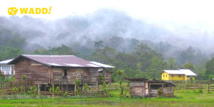
Pa'Lungan Image source via travelblog.org
This was the 5D/4N Mount Murud. The challenge was to climb the highest mountain of Sarawak and is part of the Pulong Tau National Park. We had camped for two days and then trek across to Bario, a two-day journey away, with an overnight stay in Pa’ Lungan using the Raja Buren Trail which bypasses the Indonesian border. The 3.5km Raja Buren Trail, incidentally, was named after the Kelabit name of the former State Secretary of Sarawak, YB Datuk Amar Haji Abdul Aziz Haji Husain, an avid adventurer himself.
Getting to the base camp of Mount Murud, Pa’ Rabata from Lawas had been delayed. Mechanical hitches bogged down vehicles, and broken roads transformed a 5-hour journey into eight. It was already 5 pm when we arrived at base camp. Mother Nature was definitely not smiling upon us that day. Negotiation was not an option, nor was the total reliance on one’s two limbs to get from one place to another. Our spirit was high, nevertheless.
Names of places in rural Sarawak can be quite a misnomer. Pa’ Rabata (1100m) is nothing more than a hut for respite for travellers. Here, the group was split into teams of four to five headed by a group leader for safety and security reasons. Energy food and drinks for the climb were dispensed. Never mind, the extra weight would be lessened the higher we went. Clouds hung low as the groups hiked up the 10-15° incline to Lepo Bunga (1300m); a transit hut, three kilometres into the sky.
It was a long slow slog. Drizzles came and went and clouds hemmed in thickly on us.
Need I mention the cold? The silence of the environment was at times broken by the occasional wise remarks and the laments after a lung-busting and quadriceps-burning stretch. A rare experience was in a sudden meeting with a mother deer and her young. We wondered who was more startled then; them or us?
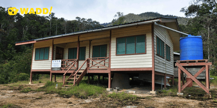
Lepo' Bunga, the research station and visitor centre Image source via http://wilsonchin.blogspot.com/
The hike part was finally over. The climb then began. From Lepo Bunga, there would be a 948m vertical gain for the next 3-km to reach Batu Linanit, the second-highest point (2248m), a kilometre before the church camp. It was now about 8 pm. Our last proper meal was a noon-time ago. We were now surviving on energy bars, raisins and whatever we could grope from each other’s backpack.
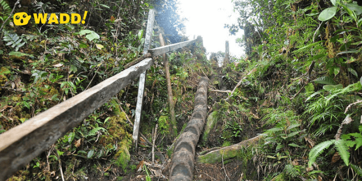
Single-digit distance between places in this environment isn’t what it was to be. The exposed roots, deep ruts, improvised handholds, slippery and broken plank-walks expanded time on their own terms. The lightest backpack became excess baggage. Try falling with it. A few did, and in the process provided some light-hearted moments in the silence of the dark.
Gladness took over when we sensed the space of the plains before us. But the 1-km trek to the church camp (2,135m) seemed like hours away. The path was incredibly treacherous; rocky, muddy, uneven and punctuated with steep drops. The bitter wind made that stretch a shuddering experience. It was well past midnight when the front pack arrived at church camp. Despite the rainfall, the camp rounded up the first day on a high note; for it gave us warmth and respite after a day of challenges. It was 11° c outside.
As we slid into our sleeping bags, wrapped in multiple layers of clothing and with Maggi mee warming our stomach, our minds drifted into what would be in store for us in four hours. The rain continued, mimicking the sounds of a thousand drums on the corrugated iron roof. The summit was still a good 3.5km away.
Daylight came, and at last, we could take in the sights of the surroundings. The church camp was a cluster of windowless wooden huts built to accommodate the thousands of pilgrims that converged on this holy mountain once a year. Certainly, an orderly approach to the usage of the land and natural resources is imperative now that this worship place lies within a national park.
Pulong Tau ('Our Forest' in Lun Bawang language) National Park, of which Mount Murud is its outstanding asset, was gazetted in 24th March 2005. It occupies an area of 59,817ha.
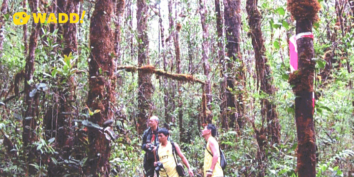
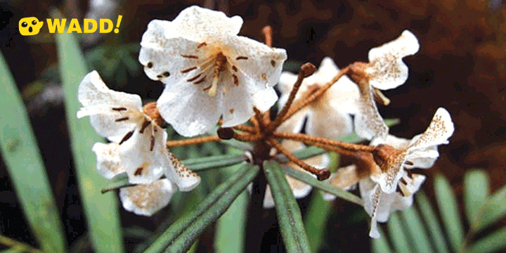
Our 2 1⁄2 hours trek to the summit took us through nature’s wonderland; thick moss wrapped around tree trunks, orchids and nepenthes of various shapes, sizes and colours provided a field day for photography and topics of conversation. The aptly- named Rock Garden broke the closeted nature of the trail. It was open and strewn with rocks of odd shapes and sizes, carved by nature.
We finally scaled the mountain. The world always looks breathtaking from a high point. Posing for the ubiquitous group photo, the memorial plaque nearby solemnly reminded us of the tragedy of a plane crash that took away the lives of a much-respected leader of the Lun Bawang community, and 5 others. In this one instance, the ugliness of the mountain was revealed, belying the tranquillity of the splendour.
- Fact 1: The four highest mountains in Malaysia are found in the East Malaysian states of Sabah and Sarawak.
- Fact 2: Gunung Murud (2,423m) is the fourth highest after Gunung Kinabalu (4,095m), Gunung Trusmadi (2,643m) and Gunung Tambuyukon (2,580m).
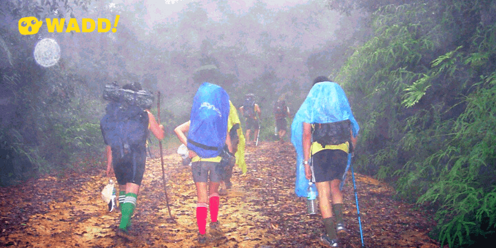
It rained the whole afternoon on our return journey from the summit to church camp. The effect was that it turned from a gently flowing stream, part of our trail earlier on, into a raging river. Thrills were aplenty. That night the temperature dropped by another degree to 10°c. There was definitely warmth in numbers, and the stove area became make-shift slumberland.
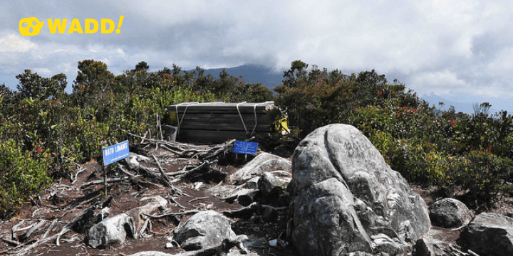
The holy ground of Batu Linanit summit Image source via wilsonchin.blogspot.com
Batu Linanit during the day gave us a fantastic panoramic view of the verdant valleys below. The clouds played hide-and-seek with the twin peak of Batu Lawi in the distance. We were now embarking on our 11-hour trek to Pa’ Lungan, an inhabited village 10-km from Bario. Using the Raja Buren trail, we would pass through Long Belaban and Long Repun; both nothing more than shelter in the jungle but everything to tired travellers. Suffice to say the leeches had a bloody fulfilling time.
Trekking over an extended period of time after the climb took a lot out of our sore muscles, strained knees and blistered feet, not to mention the mental spirit. Our backpack lent weight (pun intended) to the whole equation of discomfort. It would have been prudent to split this stretch of the journey into two days.
The consolation was that we did not have the type of treacherous surface to contend with as we did on the summit trail. Watching the leeches coiling back in ‘pain’ to the insect repellent provided some sadistic satisfaction. Singing half-remembered chorus lines and asking simple ‘What’s your favourite?’ questions enlivened the humdrum of the trek. Catching the silhouette of a rhinoceros hornbill flapping above our head was a special moment. Marvelling at the giant Agatis (Borneo’s teak) trees told us of the quality and richness of the forest.
We trudged into Pa’ Lungan well past eight in the evening; a good 13-hour trek. The first group had arrived half an hour earlier. The local folks who were looking out of their windows must have been impressed with us city folks with comments like ‘boleh tahan’ (capable). For the first time in my trekking experience, I counted 12 leech bites on my body, including an amorous one to my neck. Tights and pantyhose weren’t that effective it seemed.
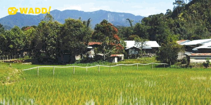
The 7-km trek to Pa’ Ukat from Pa’ Lungan would have been a simple affair if not for the soreness and blisters in the feet. But our final destination, Bario (1,060m), beckoned. The final 3-km was done in the same manner we started in; by 4x4 vehicles. In this ‘Land of a Thousand Hand Shakes’; the people here exuded friendliness and hospitality. We were feted like honoured guests. The woman folks of Rumah Asal even sang songs in our honour. We toasted to the success of our expedition. There is always a sense of peace when one comes to Bario. The vista of the wind-swept plain would cause visitors to sing praises to this most isolated enclave of the Kelabit community.
The Gunung Murud-Bario trek is a world-class experience. It encompasses the cultural, adventure and nature elements of the Sarawak’s unique selling positioning.
This is Borneo at its best!